

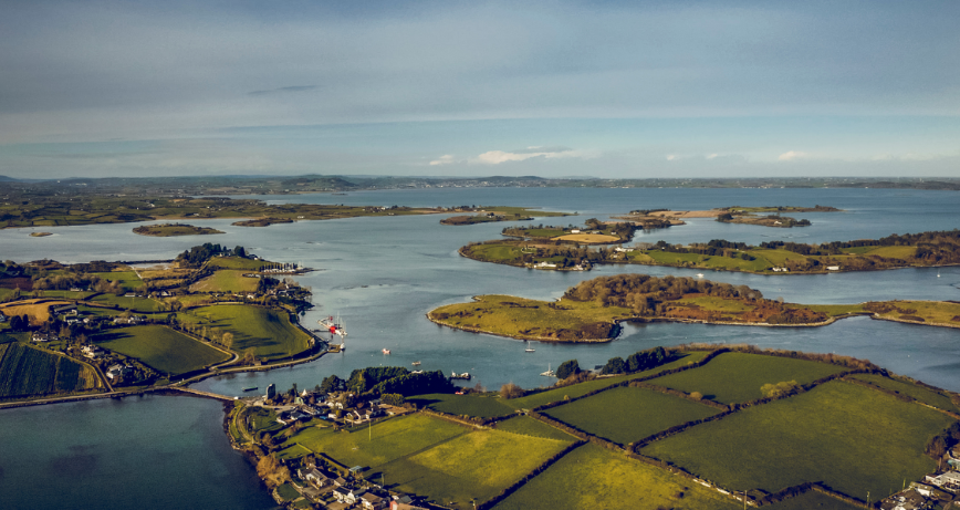
The National Trust Northern Ireland play a big part of the care of Strangford Lough, An Area of Designated Natural Beauty, the largest sea lough in the British Isles covering an area of 150 square kilometres and is one of only three marine nature reserves in the whole of the UK.
The National Trust manages over 5,000 hectares of coast and countryside in and around Strangford Lough and the Ards Peninsula. The Trust also cares for Mount Stewart located on the outskirts of Newtownards, and Castle Ward in Strangford, key visitor attractions in the area.
It is a unique and wonderful place for wildlife and people.
Find out more about the locations in their care that you can visit...
Explore key National Trust locations on the shores of Ards and North Down
We have gathered a few highlights of the many walks and scenes you can visit from 'Discover Strangford Lough and the Ards Peninsula', a National Trust brochure.
To find more detail from the brochure, visit The National Trust: Strangford Lough and the Ards Peninsula.
West shore
Reagh Island
4 miles (6 km) east of Lisbane - small car park and 0.3 miles (0.5 km) trail through woodland along the shores of Strangford Lough, which can be muddy at times.
Look out for
- The colourful jay and the majestic crack willow.
The vast majority of the foreshore from Reagh Island to Gibb’s Island
This area is managed by the Trust under lease from the Crown Estate. There are good access points at Whiterock and Killyleagh. The latter has a good array of local shops, places for refreshments, public toilets and accommodation.
Look out for
- Birds such as grey heron, redshank, and curlew. You may even spot a little egret, a recent colonist which appears to be benefiting from milder winters.
Gibb’s Island
2 miles (3 km) south of Killyleagh. The island is covered with species rich grassland and grazed with traditional cattle seasonally. Dogs are permitted on the island when livestock are present but must be kept under strict control (either on short lead or at your side). The island is linked to the mainland by a causeway. There is car parking at the end of Island Road and a mile (0.5km) circular trail which can be wet and muddy at times.
Look out for
- Wildflower meadows in the summer, which include common spotted orchid
- The woodland has a large heronry; rookery and a magical sight is the large flocks of crows coming into roost during the winter
- Long-eared owls
North Down Coast
Ballymacormick Point
Designated as an Area of Special Scientific Interest, it is located between Ballyholme Bay and Groomsport. Follow the 1.5-mile (2 km) walk (one way) along the North Down Coastal Path. This path is uneven in places and can be very muddy at times. Park at Ballyholme Bay or Groomsport.
Look out for
- Birds such as shelduck and oystercatcher.
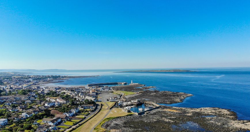
Lighthouse Island
One of the Copeland Islands, is 2 miles (3 km) off Donaghadee. This 17-hectare island was acquired by the National Trust in 1967 and is managed by Copeland Bird Observatory. The Copeland Islands are designated as a Special Protection Area under the EU Birds Directive. To arrange a visit to Lighthouse Island, please contact Copeland Bird Observatory. The bird observatory has accommodation for up to 23 overnight visitors.
Look out for
- A breeding colony of almost 3,000 pairs of Manx shearwater. These small albatross-like birds feed during the day at sea and only return to their burrows at night to avoid predators. They winter in the southern Atlantic off South America and are remarkably long-lived birds, with one ringed bird known to be at least 55 years old. At the time, this was the oldest known wild bird on the planet. It would have covered over 1,000,000km on migration during its life.
- The project to re-establish Artic tern and puffin as breeding species.
Ards Peninsula South
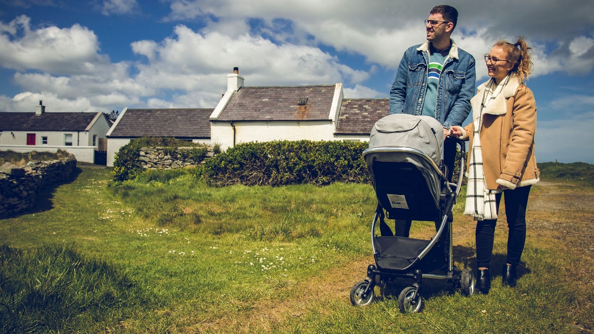
Kearney village and coastal path
On the Outer Ards, is located 3 miles (5 km) east of Portaferry. The village and coastal path have been in National Trust care since 1965 and was the Trust’s first purchase in Northern Ireland through the Enterprise Neptune scheme. The first recorded dwellings at Kearney date back to the 18th century. At one time, 30 fishing vessels operated out of Kearney and nearby Tara. Following acquisition, the Trust completely reconstructed the village based on the 1834 Ordnance Survey and all the houses are now occupied. There is a car park, public toilets and small interpretative centre at Kearney village. Visitors are welcome to walk around the village, but please respect the privacy of residents. You are welcome to walk along the coast in either direction. The Trust maintains about 2 miles (3 km) of paths along the coast, which are mostly mown grass, but can be rockier and uneven towards Knockinelder. The coastal grassland to the south of the village is grazed with traditional cattle.
Look out for
- The Silurian rocks along the shore at Kearney dating back to 400-430 million years ago when they would have been at the bottom of a deep sea.
- Rare plants growing on shingle banks along the shore, including oyster plant, sea kale and yellow-horned poppy. This is the most northerly site in Ireland for the yellow-horned poppy
- Common blue butterflies during the summer.
Knockinelder
Immediately to the west of Kearney Point. The Trust manages a couple of car parks which provide access to the lovely sandy beach. Much of the landscape around Knockinelder and Kearney is protected by a National Trust Deed of Covenant, which preserves its traditional character.
Look out for
- Pale-bellied brent geese and sandwich tern along the coast
Ballyhenry Island
1.3miles (2 km) north of Portaferry. There is space for parking a couple of cars. The island can be reached on foot at low tide, although there are no formal paths. Much of the foreshore between Ballyquintin Point and Ballyhenry Island is owned by the National Trust.
Look out for
- The wreck of the cargo liner Empire Tana, which was used in the World War II Normandy landings, sticking out of the water to the south of the island
- Rare seaweed called free-floating knotted wrack in the intertidal area at Ballyhenry. In Northern Ireland, it is only found in Strangford Lough
- Cormorants drying their wings after feeding. The aptly named Bird Island off Kircubbin has the largest colony of cormorants in Northern Ireland
Ards Peninsula North
Horse Island
1.3 miles (2 km) south of Kircubbin. This area of wet grassland and saltmarsh is managed by the Trust using grazing stock, including traditional breeds of livestock. There is a small car park off the A20 Rowreagh Road. The island can be accessed by foot at low tide.
Look out for
- One of the best examples of saltmarsh on the Lough
- Little egrets
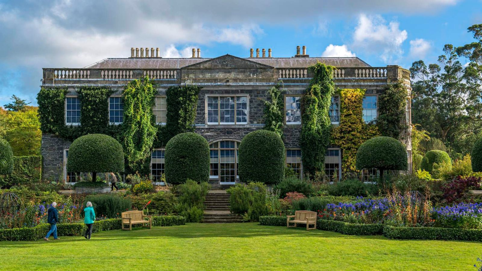
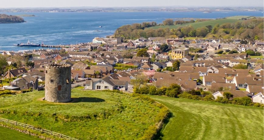
Mount Stewart House and Gardens
Signposted from Newtownards. The wildlife Strangford Lough Lookout is in Mount Stewart car park overlooking Strangford Lough. A team of staff are on hand to show visitors a variety of wildlife, together with a range of fascinating exhibits. Common seals are an important feature of the Lough and up to 200 animals can be present with peak numbers generally occurring in September. The Trust monitors common and grey seal populations on the Lough every month. The Lookout is open during weekends and bank holidays from late March to October, and Thursday to Sunday during July and August (usually between 12pm to 5pm). Admission is free. There is a 1 mile (1.7 km) red squirrel trail within Mount Stewart gardens on well surfaced paths. Mount Stewart and the Ards Peninsula has one of the few surviving populations of red squirrels in Northern Ireland.
The Ards Red Squirrel Group has been set up to protect this vulnerable population, as the non-native invasive grey squirrels are now firmly established in Newtownards and Donaghadee. For information on opening times and admission prices to Mount Stewart House and Gardens contact Mount Stewart on +44 (0)28 4278 8387 or visit nationaltrust.org.uk/mount-stewart.
Look out for
- Live pictures of nesting seabirds on a nearby island, which can be viewed in the Lookout during the breeding season.
- 6 miles of Trails with further Trails opening, plus our new Natural Play Area.
- Seals hauled up on islands, particularly at low tide.
- Red squirrels, one of the most iconic native mammals in Northern Ireland.
- Five of the eight species of bats found in Northern Ireland roost around Mount Stewart buildings. You may see them coming out in the evenings to hunt insects.
Find out more about how the National Trust care for Strangford Lough and the Ards Peninsula Way, and how you can safely enjoy exploring this stunning landscape.

Mount Stewart is a stunning estate in the beautiful scenic area of Strangford Lough. The Formal Gardens are ranked as one of the top ten in the world and the within the house there are collections of national and international significance.
Sitting on the southern tip of the famous Ards Peninsula, Kearney is a picturesque fishing village full of unspoilt, timeless character. On this short coastal walk from the village car park and visitor centre, look out for quaint, whitewashed cottages and an abundance of wildlife, from oystercatchers, rock pipits and shelducks, to winter waders and turnstones.

