

Book Tickets Online
About
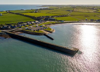
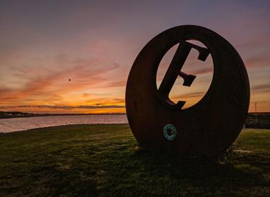
Burr Point is the most easterly point on the mainland of Northern Ireland and on the island of Ireland. It is located at longitude 5.43⁰ west, two kilometres south of Ballyhalbert and is marked by a sculpture by artist Ned Jackson Smyth.
Just offshore is the intriguingly named Burial Island. Local stories say the name comes from a Danish burial reputed to have taken place on the island. The name might also derive from the Irish for cormorant, na broighill, or from the pronunciation of “Burr Isle”. The island is a nesting site for terns.
Nearby is the small and picturesque Ballyhalbert harbour. A disused coastguard tower sits on the hill above Burr Point.
Burr Point Sculpture Artist: Ned Jackson Smyth.
**NOTE: Please park in the car park at the Harbour and explore on foot – the road to the point is strictly residents’ cars only with no turning point or parking**
Guide Prices
| Ticket Type | Ticket Tariff |
|---|---|
| Ticket | Free |
Free


